January–March Mid-century Outlook
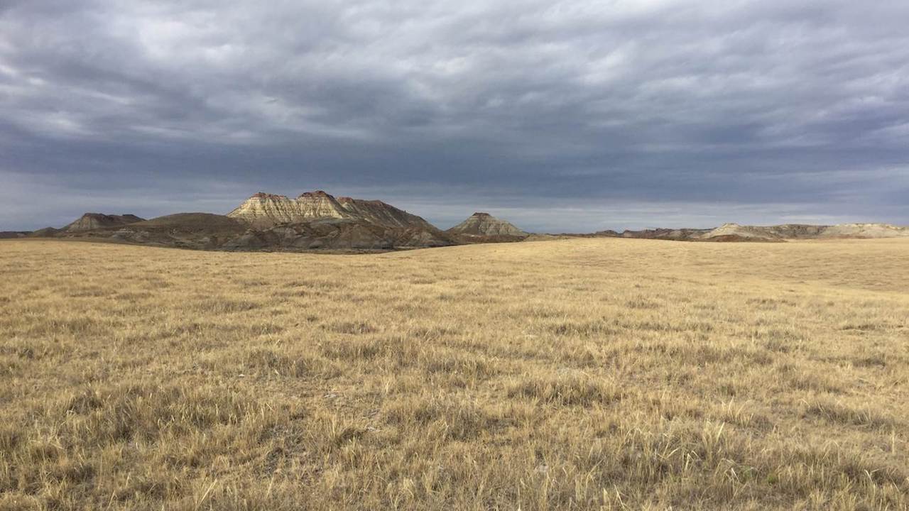
By mid-century, less precipitation will fall as snow during the winter, lessening April snowpack. Photo by Kevin Hyde.
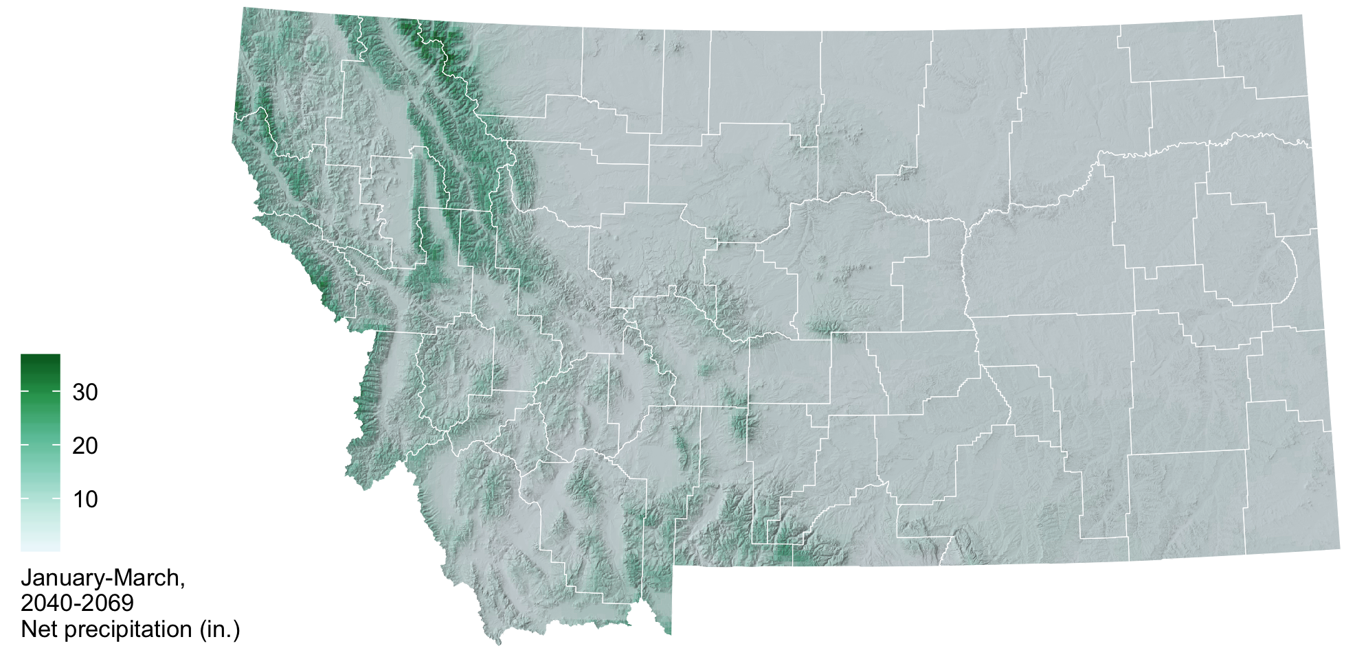
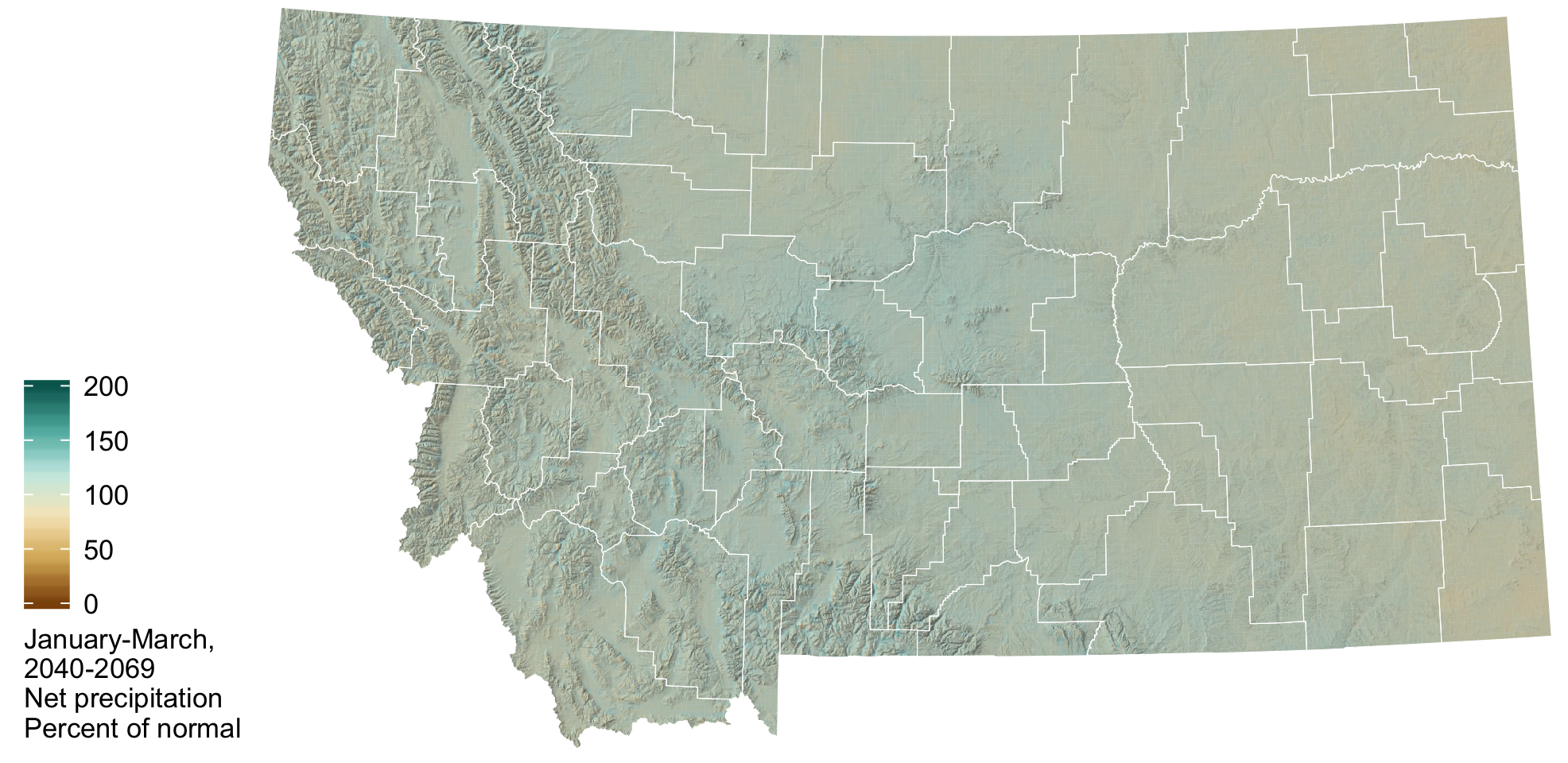
Understanding how climate change will impact agriculture in the future can be difficult. It is often helpful to compare future climate projections to the conditions that we are currently experiencing. By mid-century (2040–2069), winter will look a lot different than what we are currently experiencing in terms of increasing temperatures and reduced snowpack. Precipitation is expected to be similar in amount to 1981–2010 normal conditions, with a larger portion of total precipitation falling in the form of rain as opposed to snow.
 Temperature
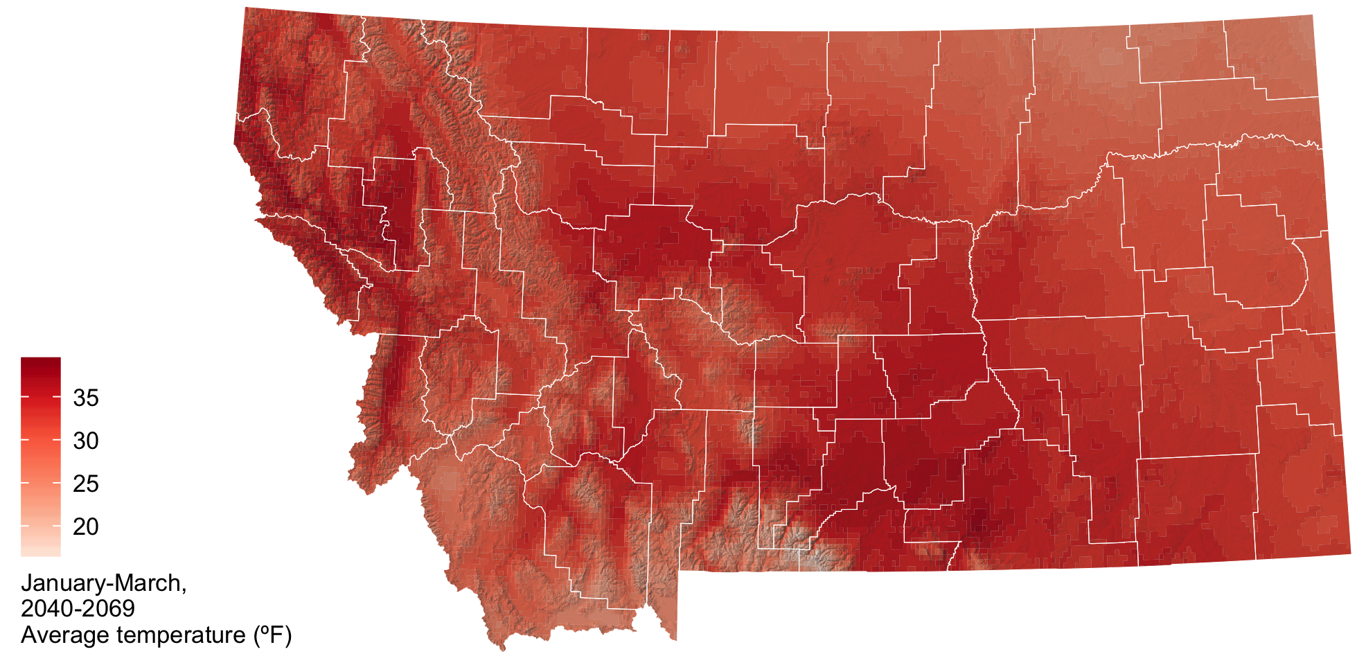
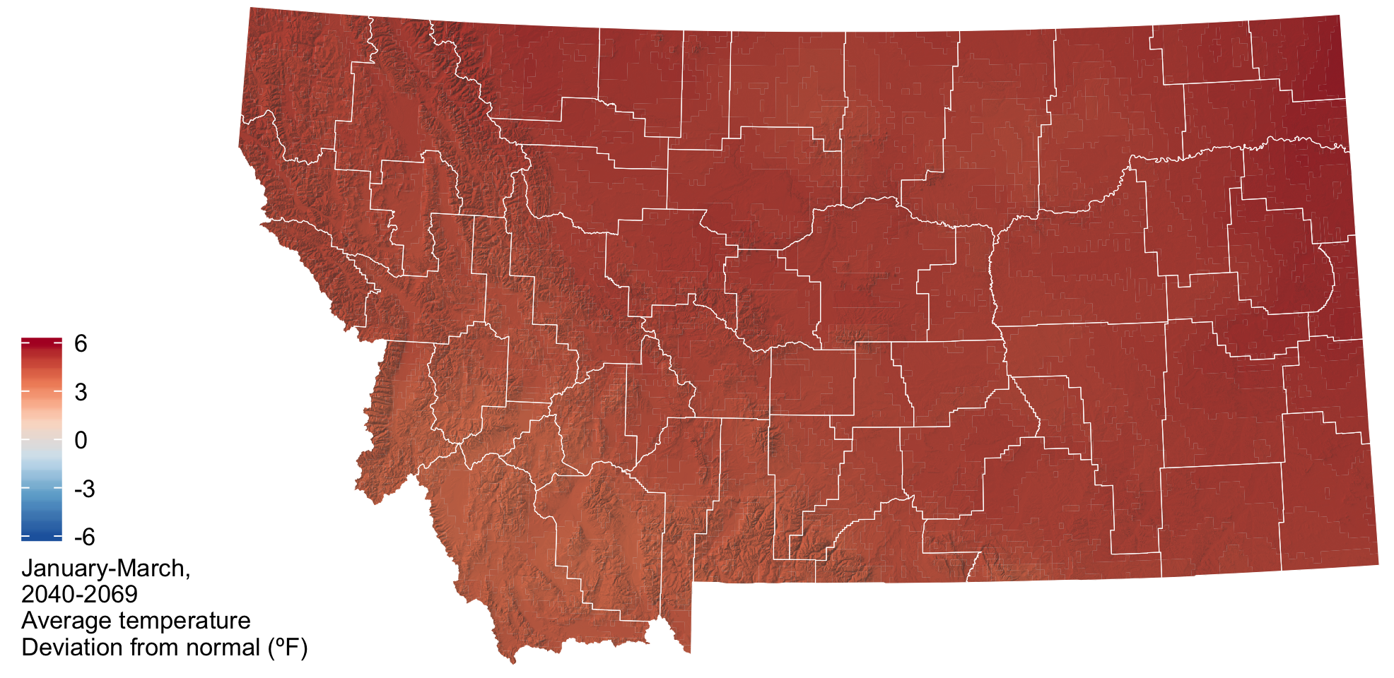
By mid-century (2040–2069), average temperatures from January through March are expected to be 4–6 degrees warmer than current temperatures. Generally, temperature is projected to increase more in eastern and central Montana relative to the northwest portions of the state. Increased temperatures will result in an earlier start to the growing season. In addition, snowmelt will occur earlier and a larger proportion of our February and March precipitation will be in the form of rain as opposed to snow.
 Precipitation
By mid-century (2040–2069) average total precipitation from January through March is expected to be similar or slightly higher than our current precipitation. Because of increasing temperatures, a larger portion of total precipitation will be in the form of rain as opposed to snow.
 Snowpack
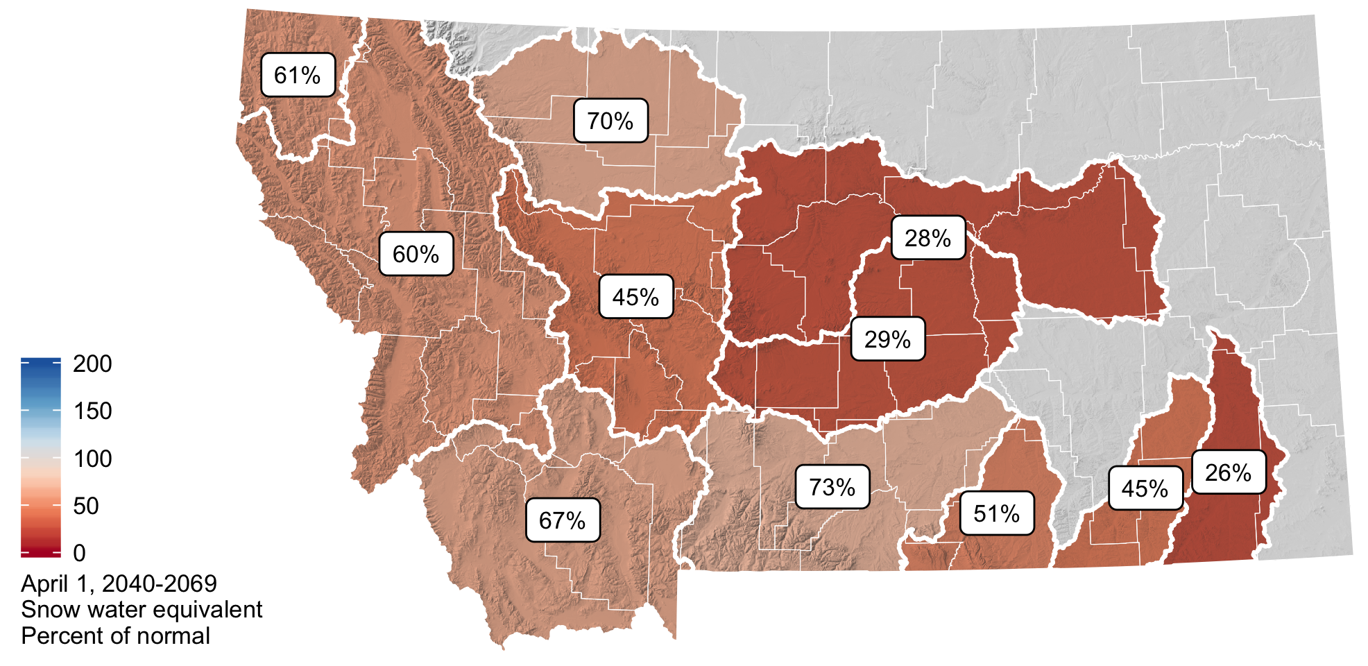
Due to increasing temperatures, a larger proportion of Montana’s total winter precipitation will fall in the form of rain as opposed to snow. Increased temperatures will result in earlier snowmelt and a significant decline in our April 1st snowpack. By midcentury (2040–2069), it is expected that April 1st SWE in the montane regions of Montana will decrease to 45–67% of our current normal values. In the plains of eastern and central Montana, snowpack is expected to decrease to between 26–51% of its current normal April 1st snow water equivalent. By mid-century, very little snowpack will persist into April in central to eastern Montana.
