Winter 2019: El Niño Arrives
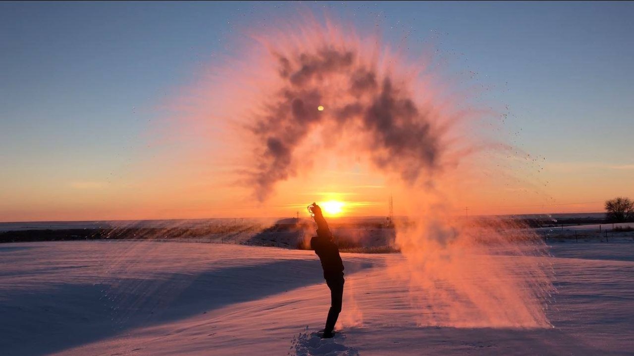
Making snow at sunset in Glasgow, MT, on February 7th. It was -16 ºF at the time, the high temperature for the day. Photo: NWS Glasgow
 Temperature
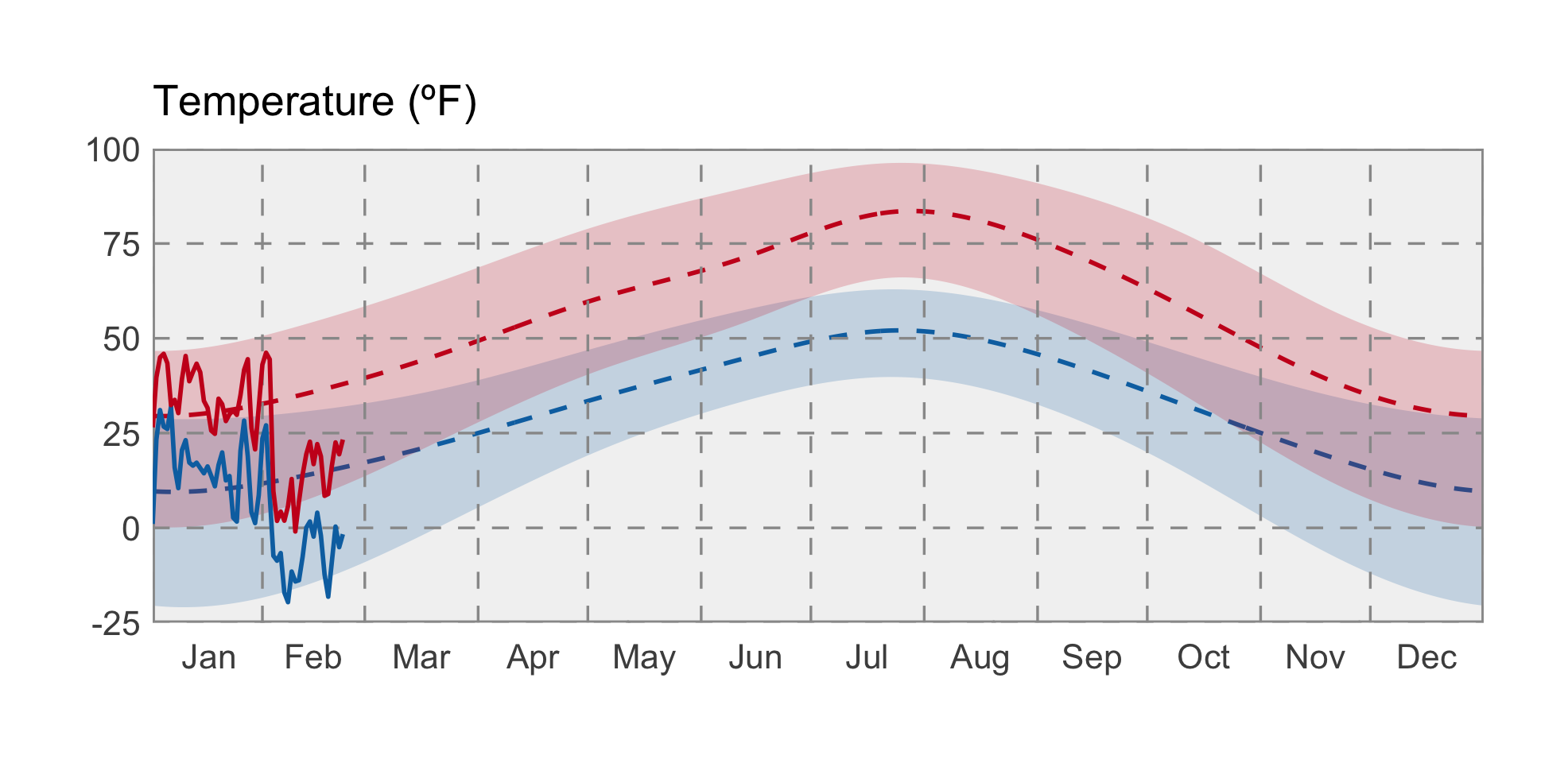
Warmer than average temperatures in December and early January have been balanced out by near record low temperatures for parts of the state in early February. Overall, temperatures this winter have been cooler than normal in the majority of western MT valley bottoms and for portions of north and south central Montana. During early winter, northeastern MT experienced warmer than normal temperatures, but cold weather in February has lowered the seasonal average down to normal or below normal.
The graph below compares historical daily temperatures (shaded bands and dashed lines) to current daily temperatures so far in 2019 (solid-jagged lines) across Montana. The shaded bands represent the range of recorded temperatures during the 1981–2010 period on any given day. The red bands and lines represent the high temperatures and the blues bands and lines represent the lows. The dashed red and blue lines represent the average high and average low temperatures during the 1981–2010 period.
 Precipitation
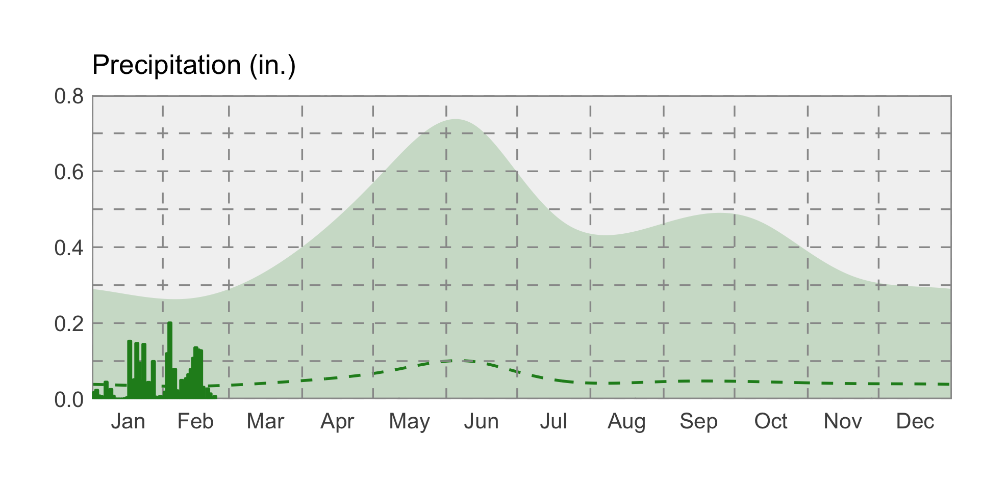
Drier than normal conditions persist in western Montana with slightly lower than normal mountain snowpack. Portions of eastern Montana have seen over 350 percent of their normal precipitation for December through February.
The graph below compares historical daily precipitation (shaded band and dashed line) to current daily precipitation so far in 2019 (vertical bars) across Montana. The shaded band represent the range of recorded precipitation during the 1981–2010 period on any given day. The dashed line represents the average precipitation during the 1981–2010 period.
 Snowpack
Snowpack is very close to normal across Montana, with slightly lower than average Snow Water Equivalent (SWE) in northwest Montana (80%–100%), and slightly higher than average SWE for southern and central Montana (100%–120%). Mountain snowpack can be a good indicator of streamflow levels and the water available for diversion in the summer for areas east and west of the divide. It will be important to pay attention to spring temperatures that impact the timing of snowmelt and flooding. El Niño conditions going into the spring tilt the odds towards warmer temperatures and earlier than normal snowmelt.